The region was primarily controlled by the Spanish for the first couple centuries of contact, until the Texas Revolution. They were not particularly kind to their native populations.
Whether a Native American tribe was friendly or warlike was critical to the fates of European explorers and settlers in that land. Friendly tribes taught newcomers how to grow indigenous crops, prepare foods, and hunt wild game. Warlike tribes made life difficult and dangerous for Europeans through their attacks and resistance to the newcomers.
Colonization:
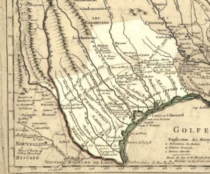
The first historical document related to Texas was a map of the Gulf Coast, created in 1519 by Spanish explorer Alonso Álvarez de Pineda. Nine years later, shipwrecked Spanish explorer Álvar Núñez Cabeza de Vaca and his cohort became the first Europeans in what is now Texas. Cabeza de Vaca reported that in 1528, when the Spanish landed in the area, “half the natives died from a disease of the bowels and blamed us.”

European powers ignored the area until accidentally settling there in 1685. Miscalculations by René-Robert Cavelier de La Salle resulted in his establishing the colony of Fort Saint Louis at Matagorda Bay rather than along the Mississippi River. The colony lasted only four years before succumbing to harsh conditions and hostile natives.
In 1690 Spanish authorities, concerned that France posed a competitive threat, constructed several missions in East Texas. After Native American resistance, the Spanish missionaries returned to Mexico. When France began settling Louisiana, mostly in the southern part of the state, Spanish authorities responded by founding a new series of missions in East Texas in 1716. Two years later, they created San Antonio as the first Spanish civilian settlement in the area.
Hostile native tribes and distance from nearby Spanish colonies discouraged settlers from moving to the area. It was one of New Spain‘s least populated provinces. Between 1749 and 1785 most tribes had signed peace treaties with the Spanish. With more numerous missions being established, priests led a peaceful conversion of most tribes. By the end of the 18th century only a few nomadic tribes had not converted to Christianity.

When the United States purchased Louisiana from France in 1803, American authorities insisted the agreement also included Texas. The boundary between New Spain and the United States was finally set at the Sabine River in 1819, at what is now the border between Texas and Louisiana. In 1821, the Mexican War of Independence included the Texas territory, which became part of Mexico. Due to its low population, Mexico made the area part of the state of Coahuila y Tejas.
Hoping more settlers would reduce the near-constant Comanche raids, Mexican Texas liberalized its immigration policies to permit immigrants from outside Mexico and Spain. Under the Mexican immigration system, large swathes of land were allotted to empresarios, who recruited settlers from the United States, Europe, and the Mexican interior. The first grant, to Moses Austin, was passed to his son Stephen F. Austin after his death.
