
Alberta has two main east-west corridors. The southern corridor, part of the Trans-Canada Highway system, enters the province near Medicine Hat, runs westward through Calgary, and leaves Alberta through Banff National Park. The northern corridor, also part of the Trans-Canada network and known as the Yellowhead Highway (Highway 16), runs west from Lloydminster in eastern Alberta, through Edmonton and Jasper National Park into British Columbia. One of the most scenic drives is along the Icefields Parkway, which runs for 142 miles between Jasper and Lake Louise, with mountain ranges and glaciers on either side of its entire length. A third corridor stretches across southern Alberta; Highway 3 runs between Crowsnest Pass and Medicine Hat through Lethbridge and forms the eastern portion of the Crowsnest Highway. Another major corridor through central Alberta is Highway 11 (also known as the David Thompson Highway), which runs east from the Saskatchewan River Crossing in Banff National Park through Rocky Mountain House and Red Deer, connecting with Highway 12 12 miles west of Stettler. The highway connects many of the smaller towns in central Alberta with Calgary and Edmonton, as it crosses Highway 2 just west of Red Deer.
Public Transit:
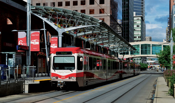
Calgary, Edmonton, Red Deer, Medicine Hat, and Lethbridge have substantial public transit systems. In addition to buses, Calgary and Edmonton operate light rail transit (LRT) systems. Edmonton LRT, which is underground in the downtown core and on the surface outside the CBD, was the first of the modern generation of light rail systems to be built in North America, while the Calgary C-Train has one of the highest number of daily riders of any LRT system in North America.
Air:
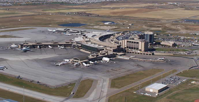
Alberta is well-connected by air, with international airports in both Calgary and Edmonton. Calgary International Airport and Edmonton International Airport are the fourth- and fifth-busiest in Canada, respectively. Calgary’s airport is a hub for WestJet Airlines and a regional hub for Air Canada. Calgary’s airport primarily serves the Canadian prairie provinces (Alberta, Saskatchewan and Manitoba) for connecting flights to British Columbia, eastern Canada, 15 major U.S. centers, nine European airports, one Asian airport and four destinations in Mexico and the Caribbean. Edmonton’s airport acts as a hub for the Canadian north and has connections to all major Canadian airports as well as 10 major U.S. airports, 3 European airports and 6 Mexican and Caribbean airports.
Rail:
There are more than 5,600 miles of operating mainline railway in Alberta. The vast majority of this trackage is owned by the Canadian Pacific Railway and Canadian National Railway companies, which operate railway freight across the province. Additional rail freight service in the province is provided by two short line railways: the Battle River Railway and Forty Mile Rail. Passenger trains include Via Rail’s Canadian (Toronto–Vancouver) or Jasper–Prince Rupert trains, which use the CN mainline and pass through Jasper National Park and parallel the Yellowhead Highway during at least part of their routes. The Rocky Mountaineer operates two sections: one from Vancouver to Banff and Calgary over CP tracks, and a section that travels over CN tracks to Jasper.
Flag of Alberta:
The flag of Alberta is an official symbol of the province of Alberta, Canada. In 1968, the provincial legislature authorized the design of a flag, adopting it on 1 June 1968.