French Canadian and métis trappers and missionaries arrived in the eastern part of the state in the late 18th and early 19th centuries, many having travelled as members of Lewis and Clark and the 1811 Astor expeditions. Some stayed permanently, including Étienne Lussier, believed to be the first European farmer in the state of Oregon. The evidence of this French Canadian presence can be found in the numerous names of French origin in that part of the state, including Malheur Lake and the Malheur River, the Grande Ronde and Deschutes rivers, and the city of La Grande.
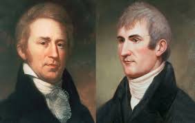
The Lewis and Clark Expedition travelled through northern Oregon also in search of the Northwest Passage. They built their winter fort in 1805–06 at Fort Clatsop, near the mouth of the Columbia River, staying at the encampment from December until March.
British explorer David Thompson also conducted overland exploration. In 1811, while working for the North West Company, Thompson became the first European to navigate the entire Columbia River. Stopping on the way, at the junction of the Snake River, he posted a claim to the region for Great Britain and the North West Company. Upon returning to Montreal, he publicized the abundance of fur-bearing animals in the area.
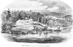
Also in 1811, New Yorker John Jacob Astor financed the establishment of Fort Astoria at the mouth of the Columbia River as a western outpost to his Pacific Fur Company; this was the first permanent European settlement in Oregon.
In the War of 1812, the British gained control of all Pacific Fur Company posts. The Treaty of 1818 established joint British and American occupancy of the region west of the Rocky Mountains to the Pacific Ocean.
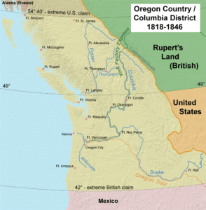
By the 1820s and 1830s, the Hudson’s Bay Company dominated the Pacific Northwest from its Columbia District headquarters at Fort Vancouver, across the Columbia River from present day Portland.
In 1841, Sir George Simpson, governor of the Hudson’s Bay Company, reversed the Hudson’s Bay Company’s long-standing policy of discouraging settlement because it interfered with the lucrative fur trade. He directed that some 200 Red River Colony settlers be relocated to HBC farms near Fort Vancouver, the James Sinclair expedition, in an attempt to hold Columbia District.
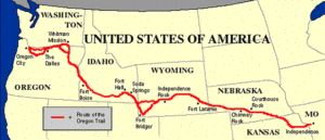
Starting in 1842–43, the Oregon Trail brought many new American settlers to the Oregon Country.
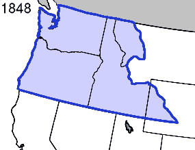
For some time, it seemed that Britain and the United States would go to war for a third time in 75 years, but the border was defined peacefully in 1846 by the Oregon Treaty. The border between the United States and British North America was set at the 49th parallel. The Oregon Territory was officially organized on August 13, 1848.
Settlement increased with the Donation Land Claim Act of 1850 and the forced relocation of the native population to Indian reservations in Oregon.
Statehood:
Slavery played a major part in Oregon’s history and even influenced its path to statehood. The territory’s request for statehood was delayed several times, as members of Congress argued among themselves whether the territory should be admitted as a “free” or “slave” state. Eventually politicians from the south agreed to allow Oregon to enter as a “free” state, in exchange for opening slavery to the southwest United States.
