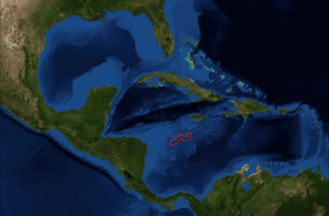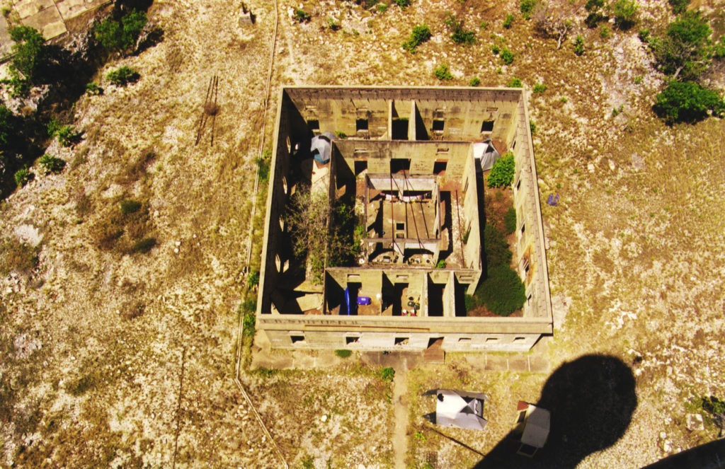
Beacon Cay is the largest islet in the Bank. It is overbuilt with small military facilities, which house a small rotating garrison of Colombian naval personnel. There is a lighthouse on a coral ledge in the southwest approach to the bank. It is a 108 foot tall skeletal tower built atop a 3-storey crew residence. The lamp emits a focal plane beam of light as two white flashes every 20 seconds. The current lighthouse was first erected in 1982, and was reconstructed in May 2008 by the Colombian Ministry of Defense. It is currently maintained by the Colombian Navy, and overseen by the state’s Maritime Authority.
History:
The Serranilla Bank was first shown on Spanish maps in 1510 as Placer de la Serranilla. It was mentioned by Louis-Michel Aury whose ship was shipwrecked on it in 1820. In later history it has been the subject of conflicting claims made by a number of sovereign states. In most cases, the dispute stems from attempts by a state to expand its exclusive economic zone over the surrounding seas.
Between 1982 and 1986, Colombia maintained a formal agreement with Jamaica which granted regulated fishing rights to Jamaican vessels within the territorial waters of Serranilla Bank and nearby Bajo Nuevo Bank. In November 1993, the two states agreed upon a maritime delimitation treaty establishing a “Joint Regime Area” to cooperatively manage and exploit living and non-living resources in designated waters between the two banks. However, the territorial waters immediately surrounding the cays themselves were excluded from the zone of joint-control, as Colombia considers these areas to be part of her coastal waters. The agreement came into force in March 1994.
Nicaragua lays claim to all the islands on its continental shelf, covering an area of over 19,000 square miles in the Caribbean Sea, including the Serranilla Bank and all islands associated with the San Andrés and Providencia archipelagoes. It has persistently pursued this claim against Colombia in the International Court of Justice (ICJ), filing cases in both 2001 and 2007.
The United States’ claim was made in 1879 and 1880 under the Guano Islands Act by James W. Jennett. Most claims made by the U.S. over the guano islands in this region were officially renounced in a treaty with Colombia, dated September 1972. But whether or not Serranilla Bank was included in the agreement is disputed—there is no specific mention of the feature in the treaty and, as per Article 7 of the said treaty, only matters specifically mentioned in the document are subject to it. According to other records, as well as claims made within the ICJ, Colombia is recognized by the United States as having varying degrees of sovereignty over Serranilla Bank through the treaty of 1972, which took effect in September 1981. The U.S. considers the reef to be an unorganized, unincorporated United States territory.
Honduras claims Serranilla Bank as part of its national territory in Article 10 of its Constitution. In 1986, it agreed upon a maritime boundary demarcation with Colombia that excluded Honduras of any control over the bank or its surrounding waters. The ratification of this boundary on 20 December 1999 proved to be controversial within Honduras, as it ensured that the state implicitly recognised Colombia’s sovereignty over the claimed territory. Nicaragua, which has not resolved its maritime borders with Honduras or Colombia, disputed Honduras’ legal right to hand over these areas before the ICJ. Despite the agreement with Colombia, however, the Honduran government has yet to officially renounce the claim in the Constitution.
Navassa Island
Introduction:
Navassa Island is a small uninhabited island in the Caribbean Sea. Located northeast of Jamaica, south of Cuba, 40 nautical miles west of Jérémie on the south west peninsula of Haiti, the island is subject to an ongoing territorial dispute between Haiti and the United States, which administers it through the U.S. Fish and Wildlife Service. The U.S. has claimed the island since 1857, based on the Guano Islands Act of 1856. Haiti’s claim over Navassa goes back to the Treaty of Ryswick in 1697 that established French possessions in Hispaniola that were transferred from Spain by the treaty. As well as the western half of the main island and certain other specifically named nearby islands, Haiti’s 1801 constitution also claimed “other adjacent (but unnamed) islands”. Navassa was not one of the named islands. Since its 1874 Constitution, and after the establishment of the 1857 U.S. claim, Haiti has explicitly named “la Navase” as one of the territories it claims.
Geography:
Navassa Island is about 2 square miles in area. It is located 35 miles west of Haiti’s southwest peninsula, 103 miles south of the US naval base at Guantanamo Bay, Cuba, and about one-quarter of the way from mainland Haiti to Jamaica in the Jamaica Channel.
