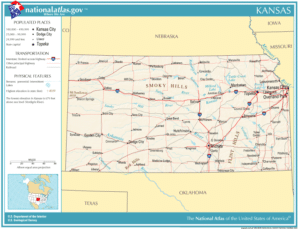
I-70 is a major east–west route connecting to Denver, Colorado and Kansas City, Missouri. Cities along this route (from west to east) include Colby, Hays, Salina, Junction City, Topeka, Lawrence, Bonner Springs, and Kansas City.
I-35 is a major north–south route connecting to Oklahoma City, Oklahoma and Des Moines, Iowa. Cities along this route (from south to north) include Wichita, El Dorado, Emporia, Ottawa, and Kansas City.
Air Travel:
The state’s only major commercial airport is Wichita Dwight D. Eisenhower National Airport, located along US-54 on the western edge of the city. Manhattan Regional Airport in Manhattan offers daily flights to Dallas/Fort Worth International Airport and Chicago’s O’Hare International Airport, making it the second-largest commercial airport in the state. Most air travelers in northeastern Kansas fly out of Kansas City International Airport, located in Platte County, Missouri, as well as Topeka Regional Airport in the state’s capital.

In the state’s southeastern part, people often use Tulsa International Airport in Tulsa, Oklahoma or Joplin Regional Airport in Joplin, Missouri. For those in the far western part of the state, Denver International Airport is a popular option. Connecting flights are also available from smaller Kansas airports in Dodge City, Garden City, Hays, Hutchinson, Liberal, or Salina.
Rail:
The Southwest Chief Amtrak route runs through the state on its route from Chicago to Los Angeles. Stops in Kansas include Lawrence, Topeka, Newton, Hutchinson, Dodge City, and Garden City.
Flag of Kansas:
Description of the Flag and the Seal:
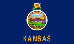
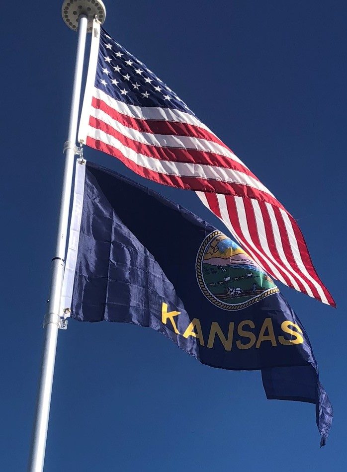
The flag of the state of Kansas was adopted in 1927. The elements of the state flag include the state seal and a sunflower. This original design was modified in 1961 to add the name of the state at the bottom of the flag.
The official flag of Kansas is represented by a dark-blue silk rectangle representing Kansas arranged horizontally with the state seal aligned in the center. Above the seal is a sunflower which sits over a bar of gold and light blue. Below the seal is printed the name of the state “KANSAS”.

The state seal centered on the flag tells the history of Kansas and his figures representing pioneer life. The seal contains:
- Landscape with a rising sun (the east)
- River and steamboat (commerce)
- Settler’s cabin and a man plowing a field (agriculture) [foreground]
- Wagon train heading west (American expansion)
- Indians hunting American Bison (the buffalo are fleeing from the Indians)
- Cluster of 34 stars (top of the seal)
- State motto “Ad Astra per Aspera” – Latin : “To the Stars through Difficulties” (above the stars)
The thirty-four stars clustered at the top of the seal identify Kansas as the 34th state to be accepted into the Union of the United States.
History of the Flag:
The flag of Kansas was designed in 1925 by Hazel Avery and first used in a Fourth of July parade in Lincoln, Kansas. The flag was officially adopted by the Kansas State Legislature in 1927 and modified in 1961 to add the word “Kansas” gold block lettering below the seal. The flag was first flown at Fort Riley by Governor Benjamin S. Paulen in 1927 for the troops at Fort Riley and for the Kansas National Guard.
