
An abundance of natural resources, excellent transportation links to the American heartland and the inland Great Lakes making ocean access possible via container ships, have all contributed to making manufacturing the principal industry of the province, found mainly in the Golden Horseshoe region, which is the largest industrialized area in Canada, the southern end of the region being part of the North American Rust Belt. Important products include motor vehicles, iron, steel, food, electrical appliances, machinery, chemicals, and paper.
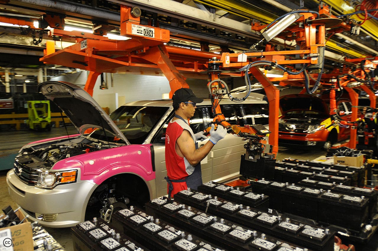
Ontario surpassed Michigan in car production, assembling 2.696 million vehicles in 2004.
Toronto, the capital of Ontario, is the center of Canada’s financial services and banking industry. Neighboring cities are home to product distribution, IT centres, and manufacturing industries. Canada’s Federal Government is the largest single employer in the National Capital Region, which centers on the border cities of Ontario’s Ottawa and Quebec’s Gatineau.
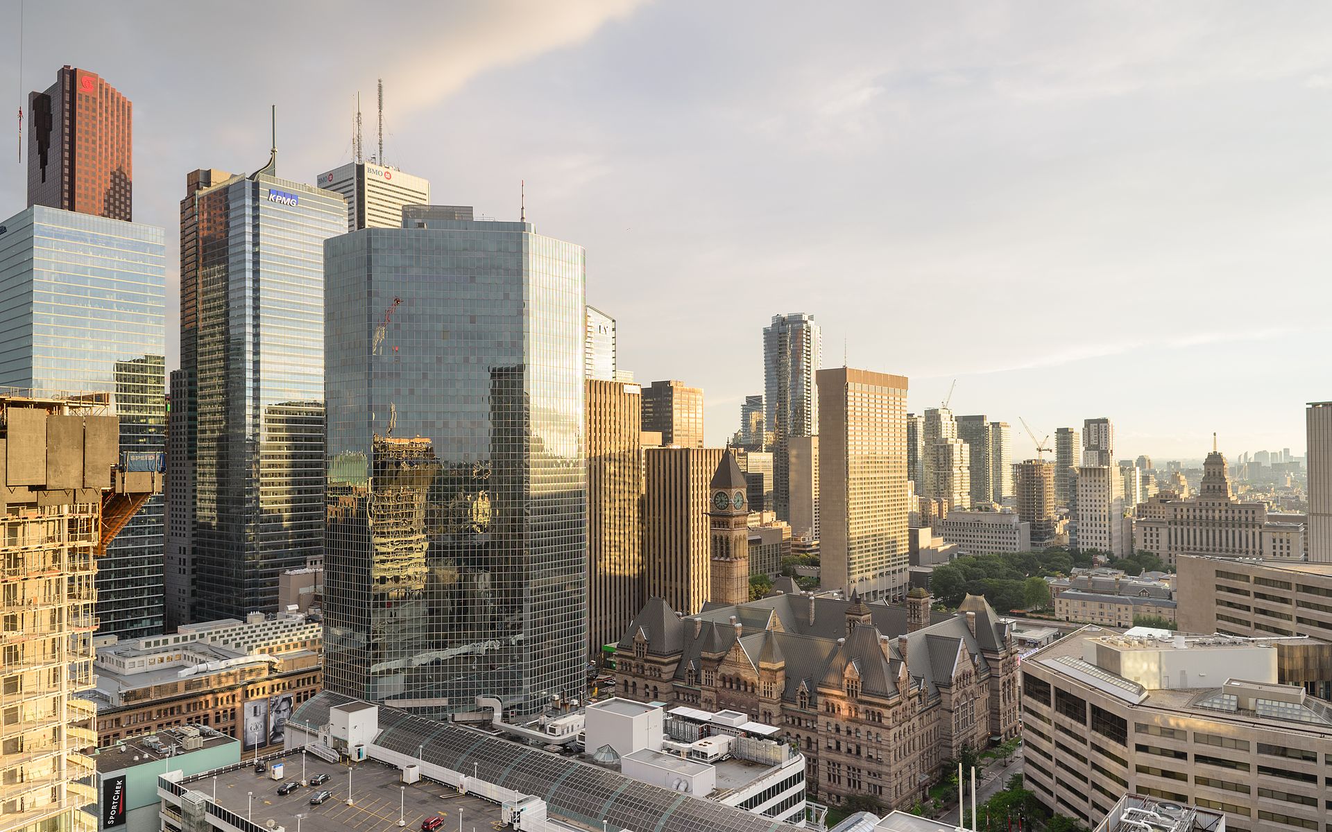
The information technology sector is important, particularly in the Silicon Valley North section of Ottawa, home to Canada’s largest technology park. IT is also important in the Waterloo Region, where the headquarters of BlackBerry is located.
Tourism contributes heavily to the economy of Central Ontario, peaking during the summer months owing to the abundance of fresh water recreation and wilderness found there in reasonable proximity to the major urban centers. At other times of the year, hunting, skiing and snowmobiling are popular. This region has some of the most vibrant fall color displays anywhere on the continent, and tours directed at overseas visitors are organized to see them. Tourism also plays a key role in border cities with large casinos, among them Windsor, Cornwall, Sarnia and Niagara Falls, the latter of which attracts millions of US and other international visitors.
Once the dominant industry, agriculture occupies a small percentage of the population. However, much of the land in southern Ontario is given over to agriculture. Common types of farms reported in the 2001 census include those for cattle, small grains and dairy. The fruit- and grape-growing industry is primarily on the Niagara Peninsula and along Lake Erie, where tobacco farms are also situated. Market vegetables grow in the rich soils of the Holland Marsh near Newmarket. The area near Windsor is also very fertile.
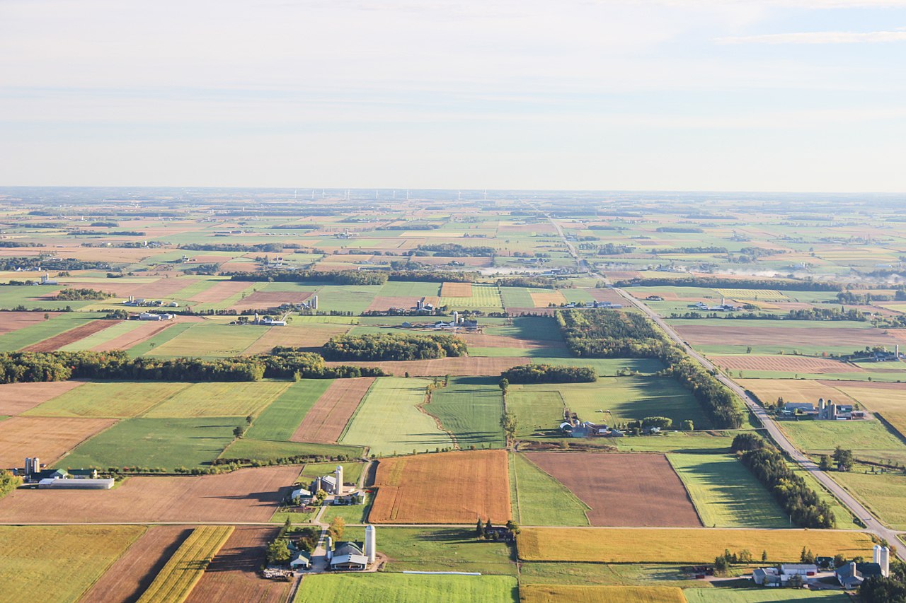
The area defined as the Corn Belt covers much of the southwestern area of the province, extending as far north as close to Goderich, but corn and soy are grown throughout the southern portion of the province. Apple orchards are a common sight along the southern shore of Nottawasaga Bay (part of Georgian Bay) near Collingwood and along the northern shore of Lake Ontario near Cobourg. Tobacco production, centered in Norfolk County, has decreased, allowing an increase in alternative crops such as hazelnuts and ginseng. The Ontario origins of Massey Ferguson, once one of the largest farm-implement manufacturers in the world, indicate the importance agriculture once[citation needed] had to the Canadian economy.
Transportation:
Transportation routes in Ontario evolved from early waterway travel and First Nations paths followed by European explorers. Ontario has two major east-west routes, both starting from Montreal in the neighboring province of Quebec. The northerly route, which was a major fur trade route, travels west from Montreal along the Ottawa River, then continues northwestward towards Manitoba. Major cities on or near the route include Ottawa, North Bay, Sudbury, Sault Ste. Marie, and Thunder Bay. The southerly route, which was driven by growth in settlements originated by the United Empire Loyalists and later other European immigrants, travels southwest from Montreal along the St. Lawrence River, Lake Ontario, and Lake Erie before entering the United States in Michigan. Major cities on or near the route include Kingston, Belleville, Peterborough, Oshawa, Toronto, Mississauga, Kitchener-Waterloo, Hamilton, London, Sarnia, and Windsor. This route was also heavily used by immigrants to the Midwestern US particularly in the late 19th century.
Roads:
400-series highways make up the primary vehicular network in the south of province, and they connect to numerous border crossings with the US, the busiest being the Detroit–Windsor Tunnel and Ambassador Bridge and the Blue Water Bridge (via Highway 402). Some of the primary highways along the southern route are Highway 401, Highway 417, and Highway 400, while other provincial highways and regional roads inter-connect the remainder of the province.