
Additionally, both the Royal Canadian Air Force and United States Air Force built and operated a number of radar stations along coastal Labrador as part of the Pinetree Line, Mid-Canada Line and DEW Line systems. Today the remaining stations are automated as part of the North Warning System, however the military settlements during the early part of the Cold War surrounding these stations have largely continued as local Innu and Inuit populations have clustered near their port and airfield facilities.
During the first half of the 20th century, some of the largest iron ore deposits in the world were discovered in the western part of Labrador and adjacent areas of Quebec. Deposits at Mont Wright, Schefferville, Labrador City, and Wabush drove industrial development and human settlement in the area during the second half of the 20th century.
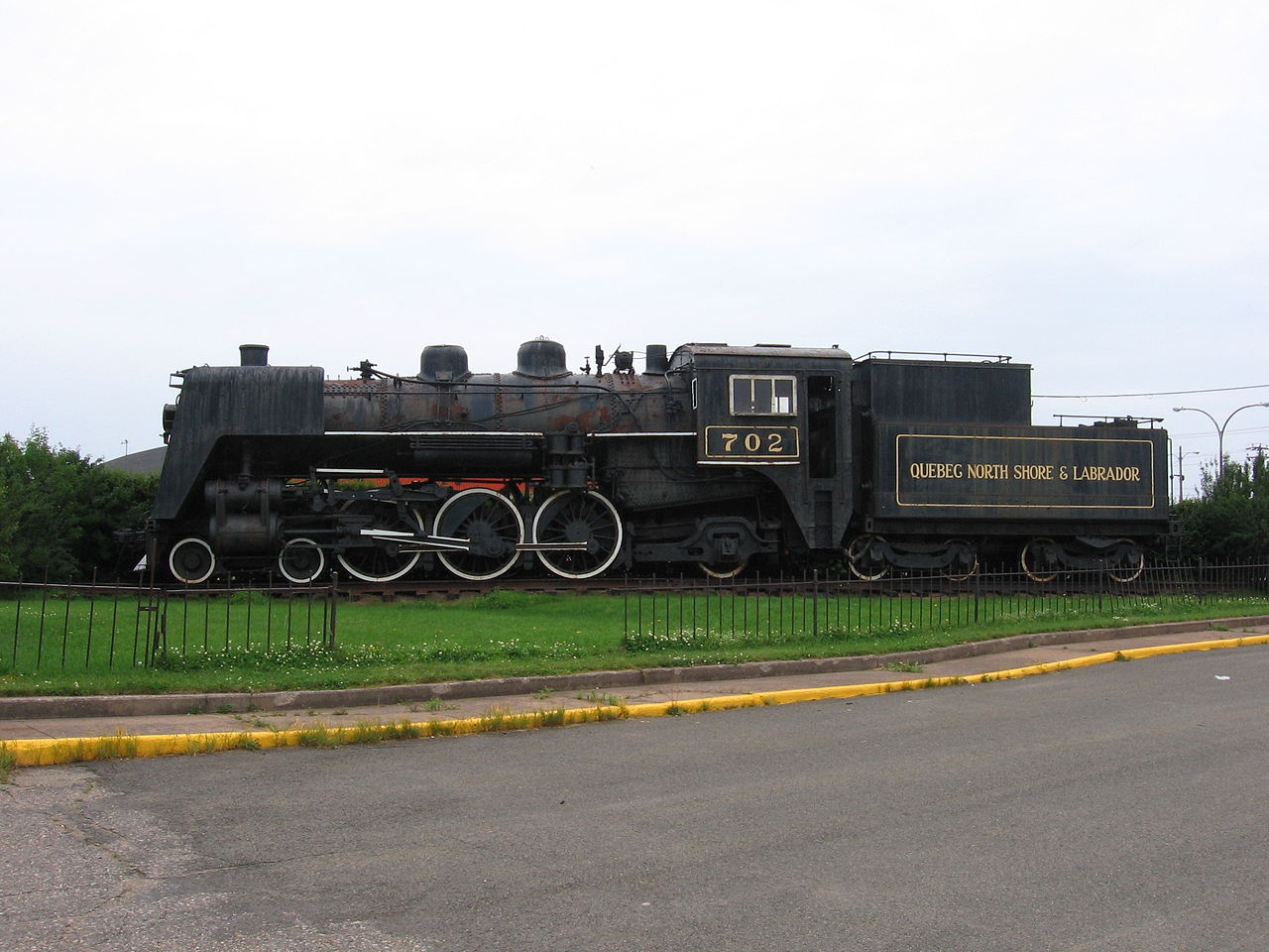
The present community of Labrador West is entirely a result of the iron ore mining activities in the region. The Iron Ore Company of Canada operates the Quebec North Shore and Labrador Railway to transport ore concentrate 359 miles south to the port of Sept-Îles, Quebec, for shipment to steel mills in North America and elsewhere.
During the 1960s, the Churchill River (Labrador name: Grand River) was diverted at Churchill Falls, resulting in the flooding of an enormous area – today named the Smallwood Reservoir after Joey Smallwood, the first premier of Newfoundland. The flooding of the reservoir destroyed large areas of habitat for the threatened Woodland Caribou. A hydroelectric generating station was built in Labrador and a transmission line to the neighbouring province of Quebec.
Construction of a large hydroelectric dam project at Muskrat Falls began in 2012 by Nalcor Energy and the Province of Newfoundland. Muskrat Falls is 45 km west of Happy Valley-Goose Bay on the Grand River (Newfoundland name: Churchill River). A transmission line began construction in October 2014 and was completed in 2016 that will deliver power down to the southern tip of Labrador and underwater across the strait of Belle Isle to the Province of Newfoundland in 2018.
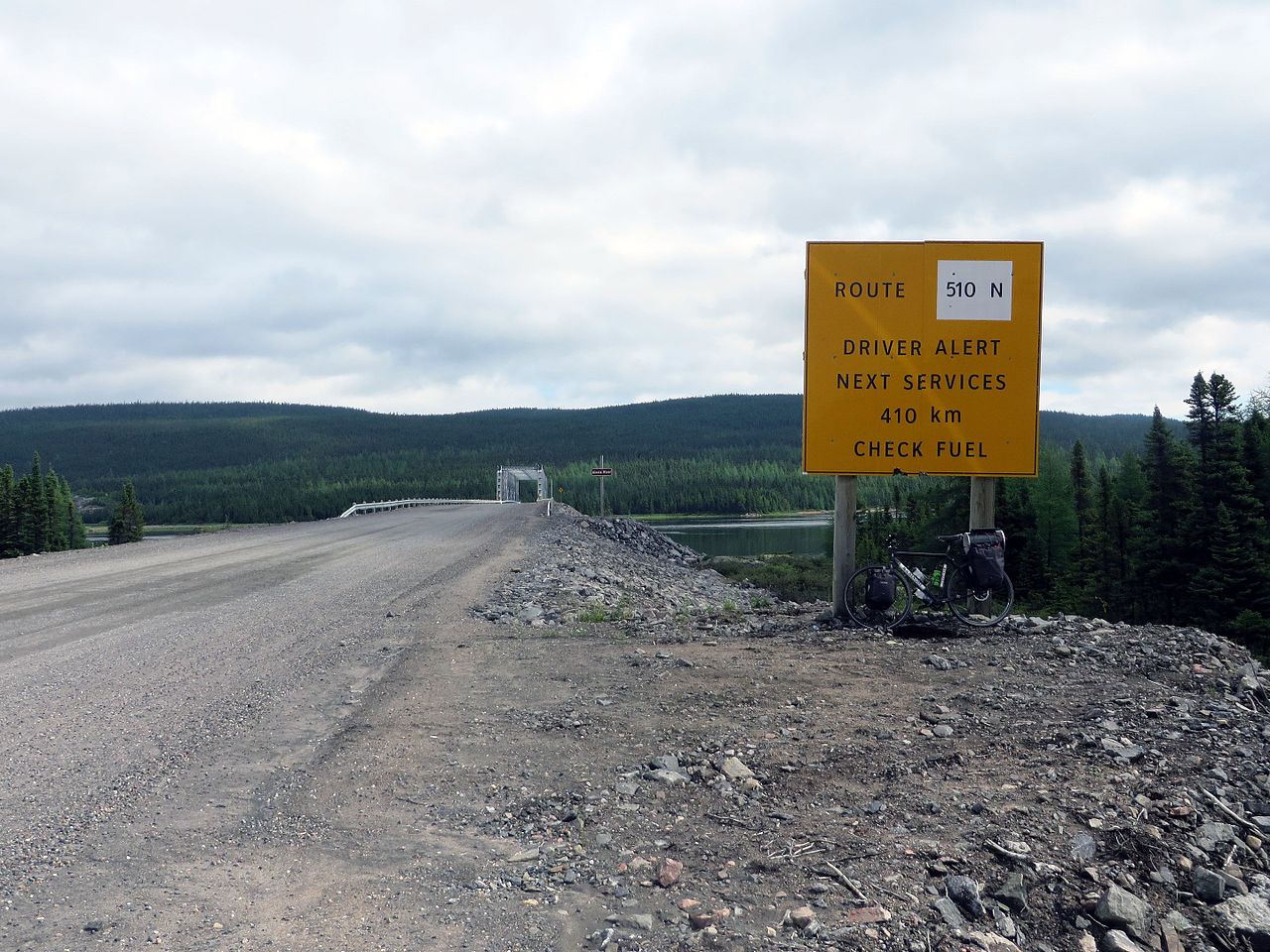
From the 1970s to early 2000s, the Trans-Labrador Highway was built in stages to connect various inland communities with the North American highway network at Mont Wright, Quebec (which in turn is connected by a highway running north from Baie-Comeau, Quebec). A southern extension of this highway has opened in stages during the early 2000s and is resulting in significant changes to the coastal ferry system in the Strait of Belle Isle and southeastern Labrador. These “highways” are so called only because of their importance to the region; they would be better described as roads, and are not completely paved.
A study on a fixed link to Newfoundland, in 2004, recommended that a tunnel under the Strait of Belle Isle, being a single railway that would carry cars, buses and trucks, was technologically the best option for such a link. However, the study also concluded that a fixed link was not economically viable. Conceivably, if built with federal aid, the 1949 terms of union would be amended to remove ferry service from Nova Scotia to Port aux Basques across the Cabot Strait.