
Although a highway link has, as of 16 December 2009, been completed across Labrador, this route is somewhat longer than a proposed Quebec North Shore highway that presently does not exist. Part of the “highway”, Route 389, starting approximately 132 miles from Baie-Comeau to 300 miles, is of an inferior alignment, and from there to 350 miles, the provincial border, is an accident-prone section notorious for its poor surface and sharp curves. Quebec in April 2009 announced major upgrades to Route 389 to be carried out.
Route 389 and the Trans-Labrador Highway were added to Canada’s National Highway System in September 2005.
Labrador constitutes a federal electoral district electing one member to the House of Commons of Canada. Due to its size, distinct nature, and large Aboriginal population, Labrador has one seat despite having the smallest population of any electoral district in Canada. Formerly, Labrador was part of a riding that included part of the Island of Newfoundland. Labrador is divided into four provincial electoral districts in the Newfoundland and Labrador House of Assembly.
Self-Government:
A Royal Commission in 2002 determined that there is some public pressure from Labradorians to break from Newfoundland and become a separate province or territory.
Some of the Innu nation (Innu people) would have the area become a homeland for them, much as Nunavut is for the Inuit; a 1999 resolution of the Assembly of First Nations claimed Labrador as a homeland for the Innu and demanded recognition in any further constitutional negotiations regarding the region.
The northern Inuit self-government region of Nunatsiavut was created in 2005 through agreements with the Government of Newfoundland and Labrador and the Government of Canada.
The Southern Inuit of Nunatukavut (NunatuKavut), who are also seeking self-government, have their land claim before the Government of Canada. The Government of Newfoundland and Labrador refuses to recognise or negotiate with the Inuit of NunatuKavut until their claim has been accepted by the Government of Canada.
Geography:
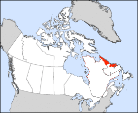
Labrador has a roughly triangular shape that encompasses the easternmost section of the Canadian Shield, a sweeping geographical region of thin soil and abundant mineral resources. Its western border with Quebec is the drainage divide of the Labrador Peninsula. Lands that drain into the Atlantic Ocean are part of Labrador, while lands that drain into Hudson Bay are part of Quebec. Northern Labrador’s climate is classified as polar, while Southern Labrador’s climate is classified as subarctic.
Labrador can be divided into four geographical regions: the North Coast, Central Labrador, Western Labrador, and the South Coast. Each of those regions is described below.
North Coast:
From Cape Chidley to Hamilton Inlet, the long, thin, northern tip of Labrador holds the Torngat Mountains, named after an Inuit spirit believed to inhabit them. The mountains stretch along the coast from Port Manvers to Cape Chidley, the northernmost point of Labrador. The Torngat Mountain range is also home to Mount Caubvick, the highest point in the province. This area is predominantly Inuit, with the exception of a small Innu community, Natuashish. The North Coast is the most isolated region of Labrador, with snowmobiles, boats, and planes being the only modern modes of transportation. The largest community in this region is Nain.